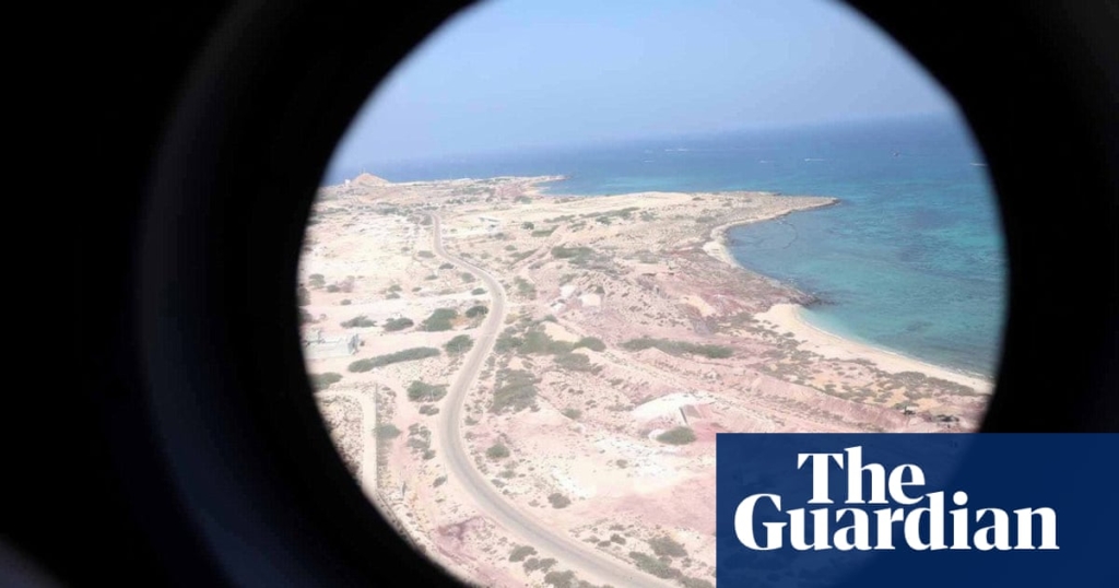
Bu içerikte, İran’ın stratejik Hormuz Boğazı su yolu girişinde bulunan üç adanın sahipliği konusundaki derinleşen anlaşmazlıkta Marquess of Salisbury’nin talimatıyla 130 yıl önce çizilen haritalardan bahsedilmektedir. İran’ın bu adalar üzerindeki iddiası, Körfez ülkeleri ile ilişkilerini bozma tehdidi oluştururken, Avrupa Birliği ile ilişkilerini geliştirmesinde ek bir engel haline gelmiştir. Bu hassas konu içerisinde, İran’ın adalara sahip olduğunu iddia etmesindeki temel argümanlar ve adaların sahipliği konusundaki tarihsel süreç detaylı bir şekilde ele alınmaktadır. Ayrıca, Avrupa Birliği’nin Birleşik Arap Emirlikleri’nin iddiasını desteklemesi ve İran’ın buna karşı verdiği tepkiler de içeriğin odak noktasını oluşturmaktadır.
Kaynak: www.theguardian.com
Maps drawn up more than 130 years ago on the instruction of the Marquess of Salisbury, the then British foreign secretary, have been cited by Iran in its deepening dispute with the Gulf states over the ownership of three strategic islands at the entrance to the critical strait of Hormuz waterway.
The dispute is threatening to damage Iran’s current efforts to form closer relations with its Gulf partners, and has also turned into an additional roadblock to improving Iran’s relations with the European Union.
The issue is hugely sensitive inside Iran and became more urgent when the EU issued a joint statement at the end of its first summit with the Gulf Cooperation Council last month that included a denunciation of the Iranian “occupation of the islands”, which it said was in breach of the UN charter and a violation of the sovereignty of the United Arab Emirates.
Faced with the new EU support for the UAE position, Iranian diplomats are citing maps drawn up by the War Office in 1888 that show the islands were perceived by Britain as part of Iran while what is now the UAE was simply termed the Pirate Coast.
The 50-year long ownership dispute between the UAE and Iran concerns three vital, thinly populated and neglected islands Abu Musa, Greater Tunb and Lesser Tunb that sit at the entrance to the strait of Hormuz, the route for oil tankers leading from the Gulf to the Gulf of Oman.
The emirate of Sharjah claims ownership of Abu Musa and the emirate of Ras al-Khaimah has a claim to the other two islands. Both emirates have since 1971 formed part of the independent UAE.
Britain occupied the islands in 1908 and ended the islands’ protectorate status in 1971 as part of its withdrawal east of Suez. The British failed to broker a deal over the Tunbs, but at the 11th hour negotiated a complex formula for Abu Musa’s future ownership, where it would be divided and jointly administered by Sharjah and Iran, then a monarchy under the control of the Shah.
Iran seized the Tunbs by force on Britain’s departure, claiming they had been part of the Persian empire since the 6th century BC. Lesser Tunb is only 1 sq mile and, according to the CIA, only populated by poisonous snakes.
In 1992 Iran expelled the Emiratis still living on Abu Musa and took full control of the island. The 5 sq mile island is now seen as Iran’s first line of defence in the strait of Hormuz and Iranian military forces have remained on the only island of the three inhabited by a civilian population, which numbers fewer than 2,000. The Iranian roads department has recently vowed to build further houses on the islands
Efforts by the UAE to take its claim to the islands to arbitration either through the international court of justice or UN itself have so far failed since Tehran has rejected third-party intervention. But the UAE has won diplomatic support from all five members of the UN security council, a rare moment in which Iran is pitted against China and Russia.
Iranian diplomats, not always the first to cite the UK as an authoritative source, are also pointing to maps in its possession given to Iran’s Shah Naser al-Din Shah Qajar by the UK ambassador Henry Drummond Wolff. The map is dated 27 July 1888, a time when the UK was well disposed to Iran since it was seeking Persian concessions and resisting Russian expansion.
In his 1892 book Persia and the Persian Question, George Curzon, the viceroy and governor-general of India, using maps prepared by the Royal Geographical Society also wrote that the islands belonged to Iran.
The UAE says the British position wavered and historically the islands belonged to the Qasimi dynasty that ruled in Sharjah.
The fact that the EU endorsed the UAE claim in a 57-paragraph broader statement has caused deep consternation within the Iran regime. A giant poster of the islands has just been unveiled in Valiasr Square in the centre of Tehran.
Abbas Araghchi, Iran’s foreign minister, took to social media, condemning the EU-GCC statement. “The three islands have always belonged to Iran and will forever remain as such. Era of European malign ‘divide & rule’ interference in our region is long over,” he posted.
His condemnation of Europe rather than the Arab states reveals how eager the Iranian foreign ministry is to avoid a row with the Arab states at a time when Iran is trying to construct a new alliance against Israel. He has already visited Oman, Qatar, Saudi Arabia and Kuwait, as well as non-Gulf states Jordan, Egypt, Lebanon, Syria, Iraq and Turkey. Araghchi’s visit to Bahrain on Monday was the first by an Iranian minister since the two sides cut ties in 2016.
However, the speaker of the Iranian parliament, Mohammad Bagher Ghalibaf, took a less diplomatic stance, saying to the Gulf states: “Instead of spending its energy on stopping the Zionist war machine, the GCC continues to make baseless claims about the territorial integrity of the Islamic Republic of Iran.”


Yorumlar kapalı.